
El Niño Winter 2026–27: A Month-by-Month Prep Plan for Utah Homeowners
Forecasters expect a record-strength El Niño, but its effect on Utah snow is uneven. A region-by-region look at the risks and a month-by-month checklist to protect a home before the storms arrive.
On October 8, 2026, NOAA's Climate Prediction Center reported that the Niño-3.4 index in the tropical Pacific had climbed to +2.1°C and put the odds of a strong-to-very-strong El Niño lasting through January–March 2027 at better than 83%. Forecasters also gave an 83% chance that the October–December period would set a new record for El Niño strength in data going back to 1950. Ski resorts have been celebrating. For homeowners, the more useful question is narrower: what does a record El Niño actually change about the winter a Utah house is likely to face, and what should be done before the first big storm?
The short answer is that the forecast raises the stakes without settling the outcome. Northern Utah could see a big year or a thin one. Southern Utah leans wetter. Either way, the jobs that protect a house from heavy snow, ice and spring runoff are the same, and most of them are cheaper in October than in February.
What the Forecast Does and Doesn't Say for Utah
El Niño tends to push the Pacific storm track toward the southern United States. That usually means wetter winters in the Desert Southwest and drier ones in the Pacific Northwest. Utah sits between those two zones, which is why the state's record under El Niño is so uneven.
- Southern Utah leans wet. Scott Handel, a lead forecaster at the Climate Prediction Center, told public radio reporters in September that the southern Intermountain West, including parts of Utah, generally favors above-normal precipitation in this setup.
- Northern Utah is a toss-up. Handel described the middle of the region, which includes northern Utah, as the zone where outcomes are hardest to call. He noted that the dividing line can shift north in strong years, but said it is not a sure thing.
- The official outlook is still neutral. As of late September, the Climate Prediction Center's preliminary winter outlook listed Utah under "equal chances" for both temperature and precipitation, with a final outlook expected in November.
- History cuts both ways. The strong El Niño winters of 1982–83 and 1997–98 produced some of Utah's best statewide snowpacks on record, roughly 133% to 160% of normal. The strong event of 2015–16, by contrast, was a below-normal snow year for Utah.
Temperature is the wild card. A warm storm can drop rain at elevations that would normally get snow. That matters to a house in two ways: wet snow is far heavier on a roof, and rain falling on an existing snowpack can send a lot of water downhill very fast.
Why a big year would land on a dry state
The 2026 water year that ended September 30 was one of the strangest on record. Utah's April 1 snowpack was the lowest since federal snow surveys began in the 1930s, and statewide reservoir storage fell to about 47% by the end of September, according to KSL's review of state and federal data. Snowpack supplies roughly 95% of the state's water, so water managers are hoping for a large winter. Homeowners can hope for the same thing and still prepare for what a large winter brings with it: roof loads, ice and a heavy runoff season.
Region by Region: Where the Risk Concentrates
Southern Utah: rain on snow and fast-rising washes
In Washington County, the risk that deserves the most attention is water, not snow. In January 2005, several inches of rain fell on fresh mountain snow, and the Santa Clara and Virgin rivers rose quickly. Bank erosion along the Santa Clara River swept away more than 20 homes in Santa Clara and St. George. Many of the damaged homes sat outside the mapped 100-year floodplain. The Utah Division of Emergency Management notes that about 40% of flood insurance claims come from outside mapped flood zones, and that St. George later joined the federal Community Rating System, which can lower flood insurance premiums for policyholders in participating communities.
Owners near a river, a wash or the base of an alluvial fan should check the Utah Geological Survey's geologic hazards map before winter. It shows mapped flood and debris-flow areas by address.
Wasatch Front: snow load, ice dams and spring basements
Along the Wasatch Front, a big winter shows up as heavy storms in the valleys, ice at the eaves and a long runoff season. Utah's record 2023 snowpack is the most recent example. On April 18, 2023, the governor declared a statewide state of emergency over flooding, landslides and related hazards, and the state had deployed more than one million sandbags by early April. Basements were a common casualty. The Utah Geological Survey's flooding page notes that shallow groundwater can flood basements and damage buried utility lines, and it invites homeowners to report groundwater flooding so the survey can map it.
Mountain towns: designed for snow, but not for neglect
Homes in Park City and other high-elevation towns are built for much larger snow loads than valley homes. Utah sets design ground snow loads that rise with elevation, and Utah State University and the Structural Engineers Association of Utah publish an address-based snow load map that engineers and building officials use. The bigger risk in ski towns is usually an empty house: a second home or nightly rental that sits unheated or unchecked during a storm cycle.
The Prep Checklist, Month by Month
October: water lines and gutters
- Shut down the sprinklers. Many secondary water systems shut off around October 1 (Roy's 2026 rules use that date). Once the supply is off, residents are typically responsible for closing their own secondary water valve. Close the stop-and-waste valve, then have the lines blown out with compressed air, zone by zone.
- Protect the culinary side. Drain or insulate any backflow preventer that ties the sprinkler system to drinking water, and disconnect garden hoses so frost-free hose bibs can drain.
- Clean gutters and extend downspouts. Clogged gutters hold ice at the eaves, and downspouts that dump next to the foundation feed a wet basement in spring. Discharge should land several feet from the house and flow away from it.
- Check the grade. Soil and flower beds should slope away from the foundation. Settled backfill along new-construction foundations is a common culprit.
November: the roof and the attic
- Look at the attic before the snow does. Ice dams form when heat leaking from the living space melts roof snow, which then refreezes at the colder eaves and backs water under the shingles. University extension services agree on the fix: air-seal gaps around light fixtures, plumbing vents, chimneys and the attic hatch, bring insulation up to the recommended depth, and keep soffit vents clear so cold air can move through the attic.
- Buy a roof rake. A long-handled rake lets an owner pull the bottom few feet of snow off the roof from the ground, which reduces ice dams without climbing.
- Know the roof's limits. FEMA's snow load guide puts the weight of one foot of fresh snow anywhere from about 3 pounds per square foot for light, dry powder to about 21 pounds for wet, heavy snow. Older roofs, additions, carports and patio covers deserve a closer look before a heavy winter.
- Consider flood insurance now. Standard homeowners policies generally exclude flood damage, and a new National Flood Insurance Program policy usually has a 30-day waiting period before coverage starts. A policy bought in November is in force well before spring runoff. One bought during a flood watch is not.
December through February: storm habits
- Clear sidewalks promptly. Many Utah cities require it. In Salt Lake City, the adjacent property owner or occupant must clear the sidewalk within 24 hours after snow stops falling, leaving a path at least 42 inches wide, and snow may not be pushed into the street. Fines rise the longer a walk stays uncleared.
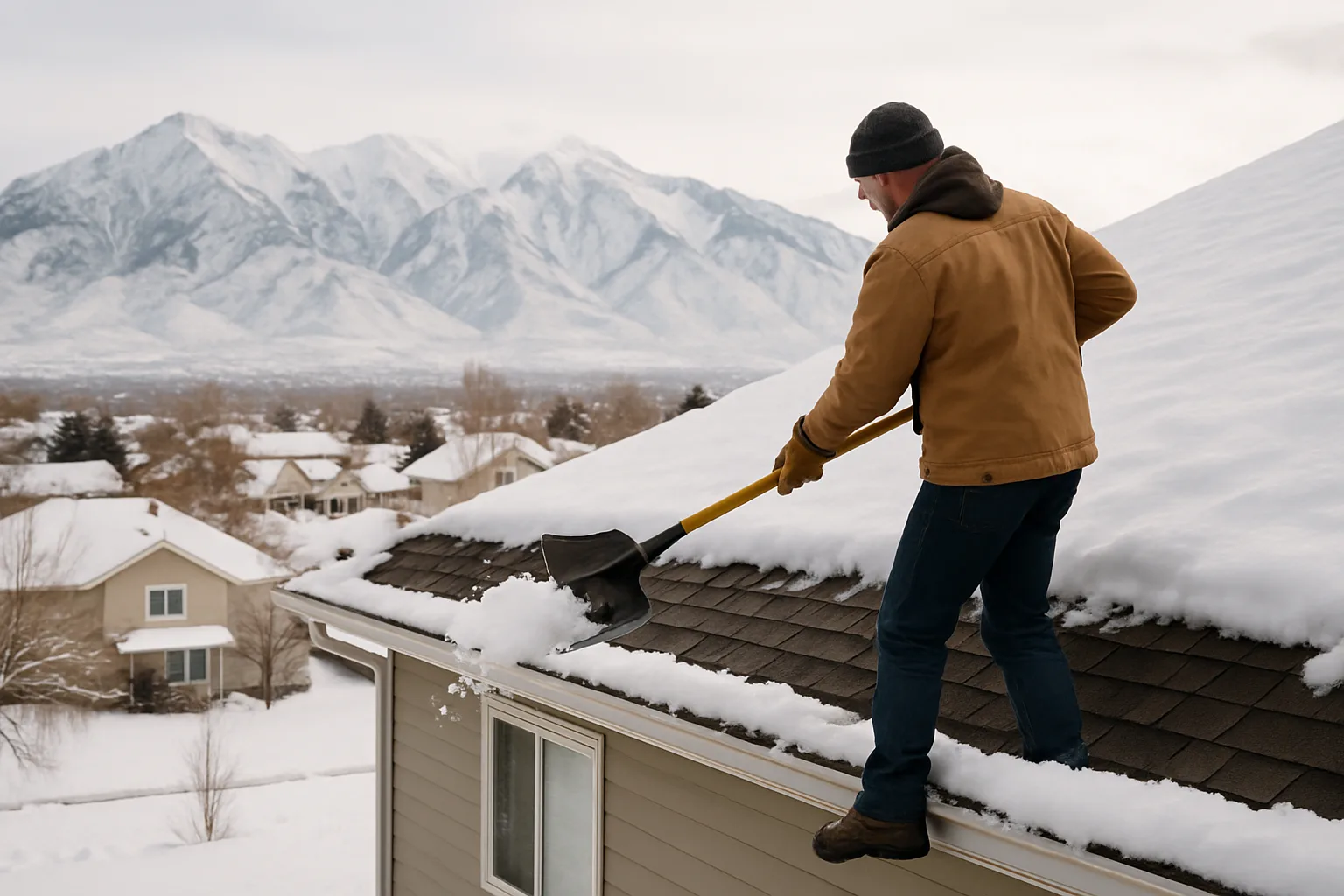
- Watch for overload signs. FEMA lists sagging ceilings or roof lines, new cracks in walls, popping or creaking sounds, and doors or windows that suddenly stick as reasons to leave the building and call a structural engineer. FEMA also warns that climbing onto a roof to shovel is often more dangerous than the snow itself.
- Keep vents and meters clear. Furnace and water heater exhaust vents on side walls, gas meters and dryer vents can all be buried by drifts or roof slides.
- Keep the heat on in empty houses. A second home should never be left fully cold. Leaving the heat on at a modest setting, shutting off the main water valve when the house is vacant, and a temperature alert or a neighbor who checks after storms prevent most frozen-pipe claims.
March through May: runoff season
- Test the sump pump. Pour water into the pit and make sure the pump starts, the discharge line is clear and frozen ends have thawed. A battery backup covers the storms that knock out power.
- Watch the window wells. Clear wells of snow and debris and add covers where meltwater collects.
- Know the local plan. Cities and counties along creeks and canyon mouths usually announce sandbag sites when snowpack is high. Owners in those areas benefit from knowing where to get them before they are needed.
Ski-Town and Second-Home Owners: A Separate List
Owners who rent a mountain property by the night, or visit only a few weekends a year, have a different problem: no one is there when the storm hits. A few steps close most of the gap.
- Contract snow removal in writing for the driveway, walks, decks and roof valleys, with a trigger depth and a response time. Guests arriving to an unplowed driveway leave poor reviews; guests slipping on an icy walk create liability.
- Map where the roof sheds. Metal roofs drop snow in sheets onto decks, hot tubs, gas meters and entry doors. Snow guards or a cleared drop zone protect both people and equipment.
- Install remote monitoring for temperature, water leaks and power loss, with alerts to the owner and the property manager.
- Review the insurance policy for vacancy clauses and short-term rental coverage before the season, not after a claim.
Buyers weighing Park City vacation rentals should ask for the roof age, any snow-load or engineering reports, past ice-dam repairs and the current snow-removal contract as part of their due diligence.
What Buyers Should Ask This Winter
A heavy winter is also a good time to see how a house really performs. Buyers touring homes between now and spring can look for ceiling stains near exterior walls, icicles concentrated over a single room (a sign of heat loss), standing water in window wells and efflorescence or damp spots on basement walls. Sellers can ask for gutter, attic and sump pump service records, and for any flood or water claims on the property. Owners getting ready for their first season in a new house can pair this list with a broader first-winter checklist.
No seasonal forecast can promise a record snow year in Salt Lake or a dry one in St. George. What the 2026–27 El Niño does is raise the chance of a winter outside the normal range, in one direction or the other. Owners who finish the October and November tasks will be ready either way. For homes, neighborhoods and market data across the state, see Best Utah Real Estate.
Frequently asked questions
Does a strong El Niño mean more snow in Utah?
Not reliably. El Niño tends to steer storms toward the southern U.S., so southern Utah leans wetter, while northern Utah sits in a transition zone where outcomes vary. The strong El Niño winters of 1982–83 and 1997–98 brought big Utah snowpacks, but 2015–16 was a below-normal snow year.
What is the El Niño forecast for winter 2026–27?
On October 8, 2026, NOAA's Climate Prediction Center gave a strong-to-very-strong El Niño better than an 83% chance of lasting through January–March 2027, with a good chance of exceeding every event on record since 1950. Its preliminary winter outlook still listed Utah as "equal chances" for temperature and precipitation, with a final outlook due in November.
How heavy can snow get on a roof?
FEMA estimates that one foot of fresh snow weighs about 3 pounds per square foot when light and dry and up to about 21 pounds per square foot when wet and heavy. Packed snow and ice weigh more for the same depth. Sagging ceilings, new wall cracks, creaking sounds or doors that suddenly stick are reasons to leave the building and call a structural engineer.
When should Utah homeowners blow out their sprinklers?
Before the first hard freeze, which usually means October. Many secondary water systems shut off around October 1, and residents are generally responsible for closing their own valve afterward. Close the stop-and-waste valve, blow each zone out with compressed air, and drain the backflow preventer.
Does homeowners insurance cover spring runoff flooding in Utah?
Standard homeowners policies generally exclude flood damage, so flood coverage must be bought separately, usually through the National Flood Insurance Program. Most new NFIP policies have a 30-day waiting period, so a policy needs to be in place well before snowmelt peaks in spring.
Who has to shovel the sidewalk in Salt Lake City?
The adjacent property owner, occupant or lessor. Salt Lake City requires snow and ice to be cleared within 24 hours after it stops falling, with a path at least 42 inches wide, and snow may not be pushed into the street. Many other Utah cities have similar rules, so owners should check their city code.
Keep reading
More from the blog

Luxury Home Auction Misconceptions, Addressed Directly

Mountain Property Buyers: Why Local Market Guidance Matters

10 Modern Home Upgrades to Help Your Utah Home Sell Faster